

Cart

Imagine trying to run a country that stretches over 2,500 miles of mountains, valleys, and deserts — all without a single text message or email! Sounds impossible, right? Yet, the Inca Empire pulled it off with style, building cities that weren’t just places to live but smart hubs to keep control over a massive and tricky landscape. So, how did they do it? Let’s dive into the clever ways the Incas organized their cities to rule such a huge empire without losing their minds (or their power).
The Inca Empire organized its cities as part of a master plan that balanced control, communication, and culture to maintain power over vast territories. Key cities like Cusco served as the political and religious heart, while smaller urban centers were strategically placed to connect different regions. Roads, terraces, and storage centers linked cities to each other, enabling efficient governance and resource sharing across mountains and valleys.
With mountains that make the Rockies look like gentle hills and weather that can switch faster than a light bulb, the Incas faced one huge challenge: how to keep such a big empire united and running smoothly. Smart city planning helped them solve this puzzle by creating places that acted like command centers, cultural hotspots, and supply depots all rolled into one.
Cusco wasn’t just any city; it was the Empire’s capital and spiritual center. It was laid out in the shape of a puma — a powerful animal in Inca culture — showing their love for symbolism and control. Cusco held government buildings, temples, and palaces, making it the hub where decisions were made and power was centralized.
The Incas built over 25,000 miles of roads connecting their cities, villages, and fortresses. These roads allowed messengers, called chasquis, to run fast and deliver important news or orders across the empire. This network was like an ancient version of texting, but with a lot more running and way less phone battery to worry about.
To handle the tough mountain terrain, the Incas built terraces that created flat farming spaces and protected cities from erosion. Cities were designed with strong stone walls and careful street layouts, helping them defend against invaders and keep citizens safe and productive.
Inca cities often had huge storage buildings called qullqas, where food and goods were stored for emergencies or military campaigns. This clever resource management meant cities could survive droughts, wars, or other crises without falling apart.
Instead of ruling every tiny village directly, the Incas let local leaders manage day-to-day life but kept a close eye through officials stationed in strategic cities. This balance helped keep diverse cultures loyal to the empire, blending local traditions with Inca rule.
By combining smart city design, fast communication, strong defenses, and careful resource planning, the Inca Empire created a network of cities that worked together like a well-oiled machine. This organization allowed them to control a vast, challenging territory with impressive efficiency and unity.
So, while the Incas didn’t have smartphones or cars, their cities were some of the most advanced and strategically planned of their time, helping them maintain one of the largest empires in history.
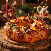
Immagina un mondo in cui le festività natalizie non finiscono il 25 dicembre. No, señoras y señores, si est...
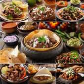
Una festa nel piatto: i segreti saporiti della cucina messicana Immagina di entrare in una fiesta messic...
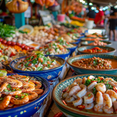
Parti per un'avventura culinaria: le meraviglie dei frutti di mare messicani Immagina questo: sei appoll...
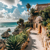
Parti per un'avventura culinaria: cibi messicani esotici che stuzzicheranno le tue papille gustative Se ...
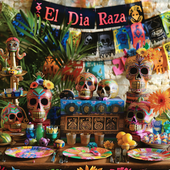
Scatena la furia festosa: forniture definitive per il tuo El Día De La Raza Bash! Immaginate questo: un ...
Benvenuti nel sacro santuario dell'umorismo, dove mescoliamo la spiritualità con un pizzico di arguzia. Ogg...
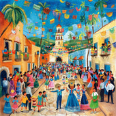
Saluti, menti curiose e amanti delle feste! Oggi ci immergiamo a cucchiaio in una tradizione che prevede ca...
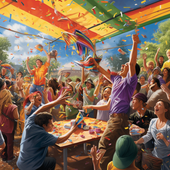
"Portare la festa a nuovi livelli: scopri l'emozionante mondo dei set di bastoni per piñata e bende per gli occ...
Una festa con un tocco musicale Radunatevi, amanti della Fiesta, per il paraorecchie più strano e delizi...

Il grande guacamole: scoprire l'amore per la cucina messicana Se c'è una cosa al mondo che è universalme...

Una festa saporita: alla scoperta delle delizie gastronomiche di un buffet messicano Ti è mai capitato di rit...
¡Ay, caramba! Dimentica di distruggere le tue comuni piñatas comprate al supermercato; è tempo di tuffarsi ...
Scatena la festa nella tua moda: l'edizione grembiule Pensateci. Quante volte vi siete ritrovati a girar...
Dai una scossa a questo Cinco De Mayo Nella gloriosa sinfonia di bicchieri tintinnanti e di allegria chi...

Signore e signori, ragazzi e ragazze, preparatevi mentre ci imbarchiamo in un viaggio colorato nel cuore de...
Hola amigos y amigas! Siete pronti a indossare il vostro sombrero e a scuotere le vostre maracas? Il Cinco ...

L'arredamento più dolce: trasformare la tua casa con l'agave Immagina di passeggiare tra i corridoi del ...
The Ultimate Fiesta: aggiungi ritmo alle tue riunioni di famiglia con la musica tradizionale messicana D...
Il curioso caso delle cartoline di ringraziamento per la riunione di famiglia messicana Immagina, se vuoi...
The Great Guacamole Gathering: come dare un tocco piccante alla tua riunione di famiglia messicana Immag...
Scopri i sapori del Messico: segreti piccanti ti aspettano in ogni buono! Benvenuti, avventurieri culinar...
Il colorato enigma: svelare il mondo delle piñata! Immagina un mondo senza piñata. Le feste di compleanno...
Una festa di tessuti e frange: la guida indispensabile per vestirsi in stile messicano! Benvenuti, mis a...
Scarta la Fiesta: bomboniere con un tocco piccante! Benvenuti, amigos e amigas, alla guida definitiva su...
Hai mai sorseggiato un margarita direttamente dal seno di un bicchiere di cactus mentre allegre melodie mar...
Una festa all'insegna della galleggiabilità: palloncini per El Grito! Immaginate questo: il cielo è tan...
Santo cielo, cos'è il Grito de Dolores? Ciao a tutti, appassionati di storia e fanatici delle feste! Vi ...
Boom! Fizzle! Pop! Ah, la sinfonia dei fuochi d'artificio del Giorno dell'Indipendenza messicana, un taco u...
La battaglia dei bulbi in fiore: un enigma colorato Avanti, signore e signori, nel mondo creativo e color...
Svelare i misteri delle tradizioni secolari Benvenuti, anime curiose e amanti della cultura! Vi è mai ca...
Scatena la tua festa interiore con stravaganti accessori per il photo booth! Immagina questo: sei a una ...
Che la festa abbia inizio: un viaggio fotografico attraverso le celebrazioni indigene del Messico Signore...
Scatena lo chef che è in te con i sapori antichi: un assaggio del Messico indigeno Immagina di brandire u...
La vasta gamma di espressioni culturali Immagina questo: stai scorrendo infinite pagine di arte murale i...
Oh mio Dio, prendi il tuo sombrero e un espresso, perché avrai bisogno di entrambe le mani libere per applau...
Ti è mai capitato di sederti a una cena, guardare il tavolo e pensare: "Cavolo, vorrei tanto vedere di più ...
Certo! Eccoci qui: Il ritmo della tradizione: alla scoperta del vivace patrimonio musicale del Messico ...
Signore, signori e tutti coloro che amano le feste, avvicinatevi perché stiamo per svelare il vivace arazzo...
Alla scoperta del tesoro: il mondo stravagante dell'artigianato indigeno messicano Prendetevi un momento...
Signore e signori, tenete i vostri tacos e preparatevi per un viaggio pirotecnico che non avete chiesto, ma...
Ammettiamolo, amigos e amigas: quando si tratta di ravvivare una fiesta, poche cose gridano "Viva il Messic...
Quando il cielo brilla: abbracciare il Fuego con una risata e una fibbia Siete mai stati a una festa mess...
Il fascino esplosivo dei cieli notturni messicani Se gli incantevoli paesaggi del Messico e le delizie c...
Svelare i fili del tempo con i manifesti indigeni messicani Perché gli antichi geroglifici egizi o le mi...
Benvenuti, lettori curiosi, nel mondo stravagante del benessere, dove l'antica saggezza incontra le risate ...
Accendi la notte con una scintilla Immagina questo: sei a casa, l'orologio batte l'ora per dare inizio a...
Il dibattito sulle fontane luminose: perché i fuochi d'artificio al chiuso sono ormai una tradizione Imm...
Esplodere di eccitazione: perché la tua festa ha bisogno di fuochi d'artificio Immaginate questo: siete ...
Signore, signori e appassionati di fuochi d'artificio di tutte le età, radunatevi! Siete stanchi delle soli...
Ammettiamolo, l'unica cosa che oscura lo spettacolo scintillante dei fuochi d'artificio è l'esibizione dell...

💖 Senti lo Spirito della Fiesta con LA AGUILA 💖 Alcune magliette sono solo tessuto, ma questa? È un simbolo della tua eredità, de...
Visualizza tutti i dettagli
🦅 Abbraccia lo Spirito di Libertà con LA ÁGUILA 🦅 Alcune magliette catturano un momento. Ma questa? È un omaggio allo spirito aud...
Visualizza tutti i dettagli
💖 Spiega le Ali con La Águila 💖 Alcune magliette sono solo dei disegni, ma questa? È il tuo spirito, la tua cultura, il tuo orgog...
Visualizza tutti i dettagli
💖 Senti lo Spirito della Tradizione, Vivi il Divertimento 💖 Ogni partita di Lotería porta con sé ricordi: risate, competizione e ...
Visualizza tutti i dettagli
💖 Abbraccia la Tua Eredità con un Tocco Audace 💖 C'è una sensazione che provi quando indossi qualcosa che è più di un semplice tes...
Visualizza tutti i dettagli
💖 Un Ricordo che Puoi Conservare per Sempre 💖 Alcune magliette sono solo vestiti, ma questa? È te. È la tua storia, la tua cultur...
Visualizza tutti i dettagli
💖 Abbraccia lo Spirito dell'Aquila 💖 Questa non è solo una maglietta. Questa è la tua occasione per indossare il simbolo di for...
Visualizza tutti i dettagli
💖 Vola Alto con un Pezzo di Tradizione 💖 Alcune maglie sono solo vestiti—ma questa? È il tuo legame con la tua eredità. Con il des...
Visualizza tutti i dettagli
💖 Senti lo Spirito di Libertà ad Ogni Indosso 💖 Alcune magliette sono più che semplici tessuti: portano con sé storie, cultura e...
Visualizza tutti i dettagli
💖 Scatena lo Scienziato che è in Te 💖 Dicono che la scienza sia un mondo a sé stante—un'avventura che svela i misteri della vita....
Visualizza tutti i dettagli
💖 Per Amore della Scienza e dello Stile 💖 Alcune magliette sono solo vestiti, ma questa? È una celebrazione di chi sei: un clinic...
Visualizza tutti i dettagli
💜 Scatena il Tuo Superpotere con Stile! 💜 Certe giornate, devi semplicemente abbracciare il cinico che è in te. E ora, puoi indos...
Visualizza tutti i dettagli
💖 Indossa la Tua Essenza, Abbraccia la Tua Cultura 💖 Alcune magliette sono solo magliette—ma questa? È la tua storia, che prende ...
Visualizza tutti i dettagli
💖 La Tua Vibrazione, La Tua Lotería 💖 Immagina di entrare in una stanza e sentire tutti gli occhi puntati su di te. Non perché ci...
Visualizza tutti i dettagli
💖 Scatena l'Icona che è in Te 💖 Alcune magliette sono solo vestiti, ma questa? È una dichiarazione. Un audace mix di divertimento...
Visualizza tutti i dettagli
💖 Il Tuo Cuore, La Tua Storia, Il Tuo Orgoglio 💖 Alcune magliette sono solo magliette, ma questa? È di più. È la tua personale ce...
Visualizza tutti i dettagli
💖 Il Tuo Stile, La Tua Storia 💖 Ogni design ha una storia, ma questo? È una celebrazione di te, racchiusa nei colori vivaci e nel...
Visualizza tutti i dettagli
💖 La Magia della Nostalgia e della Cultura Combinate 💖 Alcune magliette sono solo vestiti—ma questa? È la tua eredità. È una gioio...
Visualizza tutti i dettagli
💖 Indossa la Tua Storia, Vivi la Tua Eredità 💖 Ogni design racconta una storia, ma alcuni vanno ancora più in profondità. Immagin...
Visualizza tutti i dettagli
💖 La Tua Nuova T-Shirt Preferita 💖 Alcune magliette sono solo vestiti—ma questa? È te. È la tua storia, il tuo stile, le tue radi...
Visualizza tutti i dettagli
💖 La Tua Storia, Intessuta in Ogni Filo 💖 Immagina di indossare qualcosa che racchiuda la tua essenza, il tuo patrimonio e la tua...
Visualizza tutti i dettagli
💖 La Tua Nuova Maglietta Preferita Ti Aspetta 💖 Hai mai trovato una maglietta che sembra fatta apposta per te? È esattamente quel...
Visualizza tutti i dettagli
💖 La Tua Storia, Il Tuo Stile 💖 Alcune magliette sono solo vestiti, ma questa? È un riflesso di te. Racconta la tua storia, celeb...
Visualizza tutti i dettagli
💖 Le Tue Origini, La Tua Storia, Il Tuo Stile 💖 Alcune magliette sono più di semplici indumenti: sono un riflesso di chi sei e d...
Visualizza tutti i dettagli English


Lascia un commento