
Cart

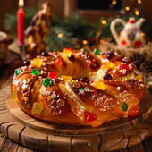
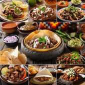
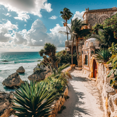
Have you ever looked at the US map and wondered, "Where exactly is Mexico?" Well, you're not alone! Mexico, a country known for its vibrant culture, delicious food, and stunning beaches, shares a huge border with the United States. So, it’s not just "down there"—it’s right next door, with tons of rich history and traditions that make it a fascinating neighbor.
Now, let’s get to the heart of the matter: where is Mexico on the map of the United States? It’s located directly to the south of the US, touching the southwestern border of the country. You’ll find Mexico below Texas, Arizona, New Mexico, and California—states that all share a border with Mexico. It’s almost like Mexico is the US’s southern hug, bringing a warm welcome from its tropical beaches and historic cities.
Knowing where Mexico is on the US map is more than just a geography lesson. It’s a gateway to understanding the cultural, historical, and economic connections between the two countries. Whether you’re planning a trip to Mexico or just curious about its location, it’s helpful to see how it’s right there—so close, yet full of adventure and discovery!
The Mexico-US border spans about 1,954 miles (3,145 kilometers), and it’s much more than just a line separating two countries. It’s a place where cultures, languages, and traditions merge. From bustling border towns like Tijuana to the deserts of Arizona, the border is a fascinating and complex region full of stories and connections.
So, to sum it up: Mexico is right below the US, stretching across its southern border. It's more than just a location—it’s a vibrant, culturally rich country that’s an integral part of the US’s history and future. Whether you're heading there for a vacation or learning about the region’s role, Mexico is always just a short distance away on the map!
Listen Now 0:00 0m 00s left – 0:00 ...
Listen Now 0:00 0m 00s left – 0:00 ...
Listen Now 0:00 0m 00s left – 0:00 ...
Listen Now 0:00 0m 00s left – 0:00 ...
Listen Now 0:00 0m 00s left – 0:00 ...
Listen Now 0:00 0m 00s left – 0:00 ...
Listen Now 0:00 0m 00s left – 0:00 ...
Listen Now 0:00 0m 00s left – 0:00 ...
Listen Now 0:00 0m 00s left – 0:00 ...

Listen Now 0:00 0m 00s left – 0:00 ...

Listen Now 0:00 0m 00s left – 0:00 ...
Listen Now 0:00 0m 00s left – 0:00 ...
Listen Now 0:00 0m 00s left – 0:00 ...

Listen Now 0:00 0m 00s left – 0:00 ...
Listen Now 0:00 0m 00s left – 0:00 ...

Listen Now 0:00 0m 00s left – 0:00 ...
Listen Now 0:00 0m 00s left – 0:00 ...
Listen Now 0:00 0m 00s left – 0:00 ...
Listen Now 0:00 0m 00s left – 0:00 ...
Listen Now 0:00 0m 00s left – 0:00 ...
Listen Now 0:00 0m 00s left – 0:00 ...
Listen Now 0:00 0m 00s left – 0:00 ...
Listen Now 0:00 0m 00s left – 0:00 ...
Listen Now 0:00 0m 00s left – 0:00 ...
Listen Now 0:00 0m 00s left – 0:00 ...
Listen Now 0:00 0m 00s left – 0:00 ...
Listen Now 0:00 0m 00s left – 0:00 ...
Listen Now 0:00 0m 00s left – 0:00 ...
Listen Now 0:00 0m 00s left – 0:00 ...
Listen Now 0:00 0m 00s left – 0:00 ...
Listen Now 0:00 0m 00s left – 0:00 ...
Listen Now 0:00 0m 00s left – 0:00 ...
Listen Now 0:00 0m 00s left – 0:00 ...
Listen Now 0:00 0m 00s left – 0:00 ...
Listen Now 0:00 0m 00s left – 0:00 ...
Listen Now 0:00 0m 00s left – 0:00 ...
Listen Now 0:00 0m 00s left – 0:00 ...
Listen Now 0:00 0m 00s left – 0:00 ...
Listen Now 0:00 0m 00s left – 0:00 ...
Listen Now 0:00 0m 00s left – 0:00 ...
Listen Now 0:00 0m 00s left – 0:00 ...
Listen Now 0:00 0m 00s left – 0:00 ...
Listen Now 0:00 0m 00s left – 0:00 ...
Listen Now 0:00 0m 00s left – 0:00 ...
Listen Now 0:00 0m 00s left – 0:00 ...
Listen Now 0:00 0m 00s left – 0:00 ...
Listen Now 0:00 0m 00s left – 0:00 ...
Listen Now 0:00 0m 00s left – 0:00 ...
Listen Now 0:00 0m 00s left – 0:00 ...

💖 Feel the Spirit of Fiesta with LA AGUILA 💖 Some shirts are just fabric—but this one? It’s a symbol of your heritage, your roots, your spirit. Des...
View full details
🦅 Embrace the Spirit of Freedom with LA ÁGUILA 🦅 Some shirts capture a moment. But this one? It’s a tribute to the bold, fearless spirit of the eag...
View full details
💖 Spread Your Wings with La Águila 💖 Some shirts are just designs—but this one? It’s your spirit, your culture, your pride—perfectly captured in a ...
View full details
💖 Feel the Spirit of Tradition, Live the Fun 💖 Every game of Lotería brings memories—laughter, competition, and those moments of pure joy. But what...
View full details
💖 Embrace Your Heritage with a Bold Twist 💖 There’s a feeling that comes when you wear something that’s more than just fabric. It’s a story, a cult...
View full details
💖 A Memory You Can Hold Forever 💖 Some shirts are just clothes—but this one? It’s you. It’s your story, your culture, your memories—all brought to ...
View full details
💖 Embrace the Spirit of the Eagle 💖 This isn’t just a T-shirt. This is your chance to wear the symbol of strength, freedom, and pride—captured in...
View full details
💖 Fly High with a Piece of Tradition 💖 Some shirts are just clothes—but this one? It’s your connection to heritage. With the bold, vibrant Águila d...
View full details
💖 Feel the Spirit of Freedom with Every Wear 💖 Some shirts are more than just fabric—they carry stories, culture, and pride. With the LA ÁGUILA Cu...
View full details
💖 Unleash Your Inner Scientist 💖 They say science is a world of its own—an adventure that unlocks the mysteries of life. But this La Cínica T-shirt...
View full details
💖 For the Love of Science and Style 💖 Some t-shirts are just clothes, but this one? It’s a celebration of who you are—a passionate clinician, a bri...
View full details
💜 Unleash Your Superpower with Style! 💜 Some days, you just have to embrace the cynic inside of you. And now, you can wear it proudly. This El Cini...
View full details
💖 Wear Your Vibe, Embrace Your Culture 💖 Some shirts are just shirts—but this one? It’s your story, brought to life in vibrant colors and playful d...
View full details
💖 Your Vibe, Your Lotería 💖 Imagine walking into a room and feeling all eyes on you. Not because you're trying, but because you're effortlessly glo...
View full details
💖 Unleash Your Inner Icon 💖 Some shirts are just clothing, but this one? It’s a statement. A bold mix of fun, style, and culture—this isn’t just an...
View full details
💖 Your Heart, Your Story, Your Pride 💖 Some shirts are just shirts, but this one? It's more. It’s your personal celebration of love, culture, and p...
View full details
💖 Your Style, Your Story 💖 Every design has a story—but this one? It’s a celebration of you, wrapped up in the vibrant colors and playful spirit of...
View full details
💖 The Magic of Nostalgia and Culture Combined 💖 Some shirts are just clothes—but this one? It’s your heritage. It’s a joyful celebration of traditi...
View full details
💖 Wear Your Story, Live Your Legacy 💖 Every design tells a story, but some go even deeper. Imagine wearing a piece of your culture, your memories, ...
View full details
💖 Your New Favorite Tee 💖 Some shirts are just clothes—but this one? It’s you. It’s your story, your vibe, your roots—expressed in a fun, unforgett...
View full details


Leave a comment