
Cart

Listen Now 0:00 0m 00s left – 0:00 ...
Listen Now 0:00 0m 00s left – 0:00 ...
Listen Now 0:00 0m 00s left – 0:00 ...
Listen Now 0:00 0m 00s left – 0:00 ...
Listen Now 0:00 0m 00s left – 0:00 ...
Listen Now 0:00 0m 00s left – 0:00 ...
Listen Now 0:00 0m 00s left – 0:00 ...
Listen Now 0:00 0m 00s left – 0:00 ...
Listen Now 0:00 0m 00s left – 0:00 ...

Listen Now 0:00 0m 00s left – 0:00 ...

Listen Now 0:00 0m 00s left – 0:00 ...
Listen Now 0:00 0m 00s left – 0:00 ...
Listen Now 0:00 0m 00s left – 0:00 ...

Listen Now 0:00 0m 00s left – 0:00 ...
Listen Now 0:00 0m 00s left – 0:00 ...

Listen Now 0:00 0m 00s left – 0:00 ...
Listen Now 0:00 0m 00s left – 0:00 ...
Listen Now 0:00 0m 00s left – 0:00 ...
Listen Now 0:00 0m 00s left – 0:00 ...
Listen Now 0:00 0m 00s left – 0:00 ...
Listen Now 0:00 0m 00s left – 0:00 ...
Listen Now 0:00 0m 00s left – 0:00 ...
Listen Now 0:00 0m 00s left – 0:00 ...
Listen Now 0:00 0m 00s left – 0:00 ...
Listen Now 0:00 0m 00s left – 0:00 ...
Listen Now 0:00 0m 00s left – 0:00 ...
Listen Now 0:00 0m 00s left – 0:00 ...
Listen Now 0:00 0m 00s left – 0:00 ...
Listen Now 0:00 0m 00s left – 0:00 ...
Listen Now 0:00 0m 00s left – 0:00 ...
Listen Now 0:00 0m 00s left – 0:00 ...
Listen Now 0:00 0m 00s left – 0:00 ...
Listen Now 0:00 0m 00s left – 0:00 ...
Listen Now 0:00 0m 00s left – 0:00 ...
Listen Now 0:00 0m 00s left – 0:00 ...
Listen Now 0:00 0m 00s left – 0:00 ...
Listen Now 0:00 0m 00s left – 0:00 ...
Listen Now 0:00 0m 00s left – 0:00 ...
Listen Now 0:00 0m 00s left – 0:00 ...
Listen Now 0:00 0m 00s left – 0:00 ...
Listen Now 0:00 0m 00s left – 0:00 ...
Listen Now 0:00 0m 00s left – 0:00 ...
Listen Now 0:00 0m 00s left – 0:00 ...
Listen Now 0:00 0m 00s left – 0:00 ...
Listen Now 0:00 0m 00s left – 0:00 ...
Listen Now 0:00 0m 00s left – 0:00 ...
Listen Now 0:00 0m 00s left – 0:00 ...
Listen Now 0:00 0m 00s left – 0:00 ...
Listen Now 0:00 0m 00s left – 0:00 ...

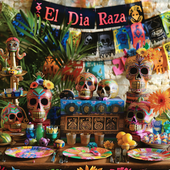
💖 Feel the Spirit of Fiesta with LA AGUILA 💖 Some shirts are just fabric—but this one? It’s a symbol of your heritage, your roots, your spirit. Des...
View full details
🦅 Embrace the Spirit of Freedom with LA ÁGUILA 🦅 Some shirts capture a moment. But this one? It’s a tribute to the bold, fearless spirit of the eag...
View full details
💖 Spread Your Wings with La Águila 💖 Some shirts are just designs—but this one? It’s your spirit, your culture, your pride—perfectly captured in a ...
View full details
💖 Feel the Spirit of Tradition, Live the Fun 💖 Every game of Lotería brings memories—laughter, competition, and those moments of pure joy. But what...
View full details
💖 Embrace Your Heritage with a Bold Twist 💖 There’s a feeling that comes when you wear something that’s more than just fabric. It’s a story, a cult...
View full details
💖 A Memory You Can Hold Forever 💖 Some shirts are just clothes—but this one? It’s you. It’s your story, your culture, your memories—all brought to ...
View full details
💖 Embrace the Spirit of the Eagle 💖 This isn’t just a T-shirt. This is your chance to wear the symbol of strength, freedom, and pride—captured in...
View full details
💖 Fly High with a Piece of Tradition 💖 Some shirts are just clothes—but this one? It’s your connection to heritage. With the bold, vibrant Águila d...
View full details
💖 Feel the Spirit of Freedom with Every Wear 💖 Some shirts are more than just fabric—they carry stories, culture, and pride. With the LA ÁGUILA Cu...
View full details
💖 Unleash Your Inner Scientist 💖 They say science is a world of its own—an adventure that unlocks the mysteries of life. But this La Cínica T-shirt...
View full details
💖 For the Love of Science and Style 💖 Some t-shirts are just clothes, but this one? It’s a celebration of who you are—a passionate clinician, a bri...
View full details
💜 Unleash Your Superpower with Style! 💜 Some days, you just have to embrace the cynic inside of you. And now, you can wear it proudly. This El Cini...
View full details
💖 Wear Your Vibe, Embrace Your Culture 💖 Some shirts are just shirts—but this one? It’s your story, brought to life in vibrant colors and playful d...
View full details
💖 Your Vibe, Your Lotería 💖 Imagine walking into a room and feeling all eyes on you. Not because you're trying, but because you're effortlessly glo...
View full details
💖 Unleash Your Inner Icon 💖 Some shirts are just clothing, but this one? It’s a statement. A bold mix of fun, style, and culture—this isn’t just an...
View full details
💖 Your Heart, Your Story, Your Pride 💖 Some shirts are just shirts, but this one? It's more. It’s your personal celebration of love, culture, and p...
View full details
💖 Your Style, Your Story 💖 Every design has a story—but this one? It’s a celebration of you, wrapped up in the vibrant colors and playful spirit of...
View full details
💖 The Magic of Nostalgia and Culture Combined 💖 Some shirts are just clothes—but this one? It’s your heritage. It’s a joyful celebration of traditi...
View full details
💖 Wear Your Story, Live Your Legacy 💖 Every design tells a story, but some go even deeper. Imagine wearing a piece of your culture, your memories, ...
View full details
💖 Your New Favorite Tee 💖 Some shirts are just clothes—but this one? It’s you. It’s your story, your vibe, your roots—expressed in a fun, unforgett...
View full details


Leave a comment